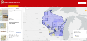
Geologic and groundwater-related maps from WGNHS are available at no charge for anyone to download. These materials are often used by state agencies, researchers, land-use planners, as well as local and county conservation planners in their work across the state. The Mapping Status Portal provides an interactive way to get a curated list of the most up-to-date WGNHS maps available for a particular area of the state. It also communicates the in-progress mapping projects.
Learn more about the project here.
Where to start? Check out the video tutorials below!
Begin Exploring Here
“This will be a one stop shop for exploring not only Pierce County maps but even some that include us across the region and state.”
-Retta Isaacson, Pierce County Water Quality Planner
More information
For more details or to give feedback on the map viewer, please contact us at: data@wgnhs.wisc.edu