August 22, 2025
Mel Reusche, WGNHS Communications and Outreach Specialist
How do we measure the impact of a map? A new study concludes that by investing in state geological surveys, we invest in our future.
“… geological maps have tremendous value to multiple economic sectors and nearly all aspects of society. Moreover, the value of geological maps accrues through time and far exceeds initial investments, with conservative estimates of monetary value ranging from 7 to 10 times higher than the production cost and per-capita input for various economic sectors ranging from ~$131 to more than $4,700 per person.”
In February 2025, the American Geosciences Institute and the American Association of State Geologists published an economic study detailing the power of geologic mapping. Geological surveys map, monitor, and research natural resources in their area which include sediment, bedrock, minerals, and groundwater. These maps are publicly available and used by state, county, local and tribal governments, other policymakers, nonprofit organizations, educators, industry, and private citizens. This work is funded by a combination of state and federal dollars and varies from state to state.
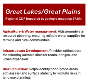
This study provides the first nationwide economic analysis of geological mapping, and for Wisconsin, the benefits for government, industry, business, and the state as a whole are clear. The percentage of gross domestic product that relies on geologic maps to support economic activities in the Great Lakes/Great Plains region, where Wisconsin is located, is an impressive 37.8%. The report identifies that geologic mapping in this region is particularly impactful in groundwater resource planning, infrastructure development, and risk mitigation in land use planning.
The WGNHS has about 30 active projects to create geological maps that directly contribute to the stewardship of soil and water resources, land use planning, and mitigation of geologic hazards. These projects are determined together with the Wisconsin Geological Mapping Advisory Committee (WGMAC): a group of professionals from both the private and public sectors assembled to ensure that the WGNHS mapping products will have an immediate and lasting impact. This maximizes our contribution across several economic sectors in Wisconsin that rely on geologic maps to conduct their work.
Impacts on Wisconsin
Southwest Wisconsin, Crawford County
Recently completed National Cooperative Geologic Mapping Program (NCGMP) STATEMAP-supported bedrock geologic mapping in Crawford County supports the Wisconsin Department of Transportation’s (WisDOT) ongoing efforts to mitigate slope failures and landslides along the Wisconsin State Highway 35 corridor, which runs adjacent to the Mississippi River. WI-35 parallels the Mississippi River through a stretch of southwest Wisconsin where it flows through a relatively narrow bedrock gorge. Due to limited space on the slope above the river, the highway is perched on a modified, often undercut slope that presents a hazard to motorists below. The new geologic mapping allows WisDOT to more accurately evaluate risk and adjust infrastructure accordingly. View this publication here.
Southcentral Wisconsin, Dodge and Jefferson counties
Dissolved arsenic in private bedrock drinking water wells is a problem in eastern Wisconsin. 3-D geologic mapping, like the recently completed NCGMP STATEMAP-supported bedrock geologic mapping in Dodge and Jefferson counties, provides new opportunities to rapidly determine the depth of geologic units in the subsurface, and determine if arsenic-bearing rock units are within the open interval of bedrock groundwater wells. Explore this maps here: Bedrock Geology of Jefferson County and Bedrock Geology of Dodge County.
Northern Wisconsin, Ashland, Bayfield, and Price counties
WGNHS scientists are completing glacial geologic mapping of Bayfield and Price counties through the NCGMP Great Lakes Geologic Mapping Coalition and with support by the U.S. Forest Service. The distribution of loose surficial sediment is important for aggregate mining of construction materials and understanding where and how quickly precipitation soaks into sand and gravel aquifers, which affects fisheries, forestry, and groundwater susceptibility to contamination. Glacial geologic mapping of surficial materials can also assist in planning for extreme flooding events, like those in 2016 and 2018 in Ashland and Bayfield counties. Explore these projects, and others, here.
More Information
Learn more about the United States Geological Survey’s National Cooperative Geologic Mapping Program.
Browse the WGNHS Publications Catalogue — all free to download!
Browse our completed and in-progress maps in our Interactive Mapping Status Portal.
Read more about our programs and projects in our blog, Survey Stories.