Director’s message
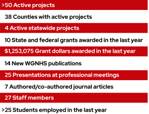
In the last year, WGNHS published new and updated maps from some of Wisconsin’s most famous geologic regions, including the Baraboo Range and the Driftless Area. We also published the first statewide bedrock topography compilation in over 50 years, as part of our growing suite of three-dimensional mapping products. With over 50 active projects, this Year in Review also highlights additional work completed in the last year beyond our new publications. There is no shortage of updates to share.
WGNHS developed a new strategic plan over the last year. We reaffirmed our mission and vision, established core values that communicate what the WGNHS stands for and the ways in which we intend to conduct our activities, and established an action plan for achieving priority initiatives over the next four years. For example, WGNHS is committed to objective, applied geoscience research to improve natural resources management and decision-making in Wisconsin. But societal needs shift over time. Therefore we will be updating our long-term bedrock, Quaternary, and hydrogeologic research and mapping plans to ensure that our work continues to address Wisconsin’s needs. WGNHS is also committed to curation of geologic data to support investigations of current and emerging geoscience issues. As the holdings in our core repository continue to grow, we are experiencing storage constraints. Therefore, we will be working with our UW-Madison colleagues to identify options for improvements to and expansion of our archival and research facilities.
The past year also included several important staff accomplishments. Congratulations to Esther Stewart on the completion of her Ph.D. in Geology at UW-Madison! Eric Carson was appointed Department of Extension Faculty Chair. Maureen Muldoon received the Division of Extension, Natural Resources Institute Supporter Award, and Dave Hart received the Division of Extension Excellence in Research Award.

As you read the updates below, you will find many other examples of the outstanding work by WGNHS staff. Thank you for your continued support of the Survey, and please consider donating to the WGNHS to further our ability to provide trusted scientific information to the residents of Wisconsin.
Sue Swanson, WGNHS Director and State Geologist
Major grant programs
National Cooperative Geologic Mapping Program (NCGMP)
WGNHS receives annual grants from the U.S. Geological Survey’s NCGMP, which comprises seven programs including STATEMAP, the Great Lakes Geologic Mapping Coalition (GLGMC), and Earth MRI. WGNHS would not be able to deliver the range of mapping products described in this Year in Review without these vital programs. Our 2025 STATEMAP award ($675,326) supports bedrock, surficial, and groundwater mapping projects across the state. The 2025 GLGMC award ($161,708) supports surficial geologic mapping in Sawyer County. Earth MRI provides resources to state geological surveys and industry to conduct geologic mapping and collect geophysical data to inventory critical economic and strategic minerals in the United States. WGNHS received $207,269 for a three-year (2024-27) mapping project at the northern edge of the Upper Mississippi Valley mining district in Iowa County.
National Geological and Geophysical Data Preservation Program (NGGDPP)
The U.S. Geological Survey’s NGGDPP program provides funding to retrieve, preserve, protect, and catalog geologic collections, including physical samples, datasets, photographs, field notes, and other records. Our 2025 grant ($79,771) supports three projects including: 1) organizing, inventorying, and making accessible our collection of passive seismic survey data, 2) making digital infrastructure upgrades to the Wisconsin Aquifer Properties Database, and 3) scanning and documenting a suite of hydrogeological reports for eventual upload to the Aquifer Properties Database. Archivist Brad Gottschalk leads these efforts for the WGNHS.
Bedrock geologic mapping and research
Geology of the Baraboo Hills
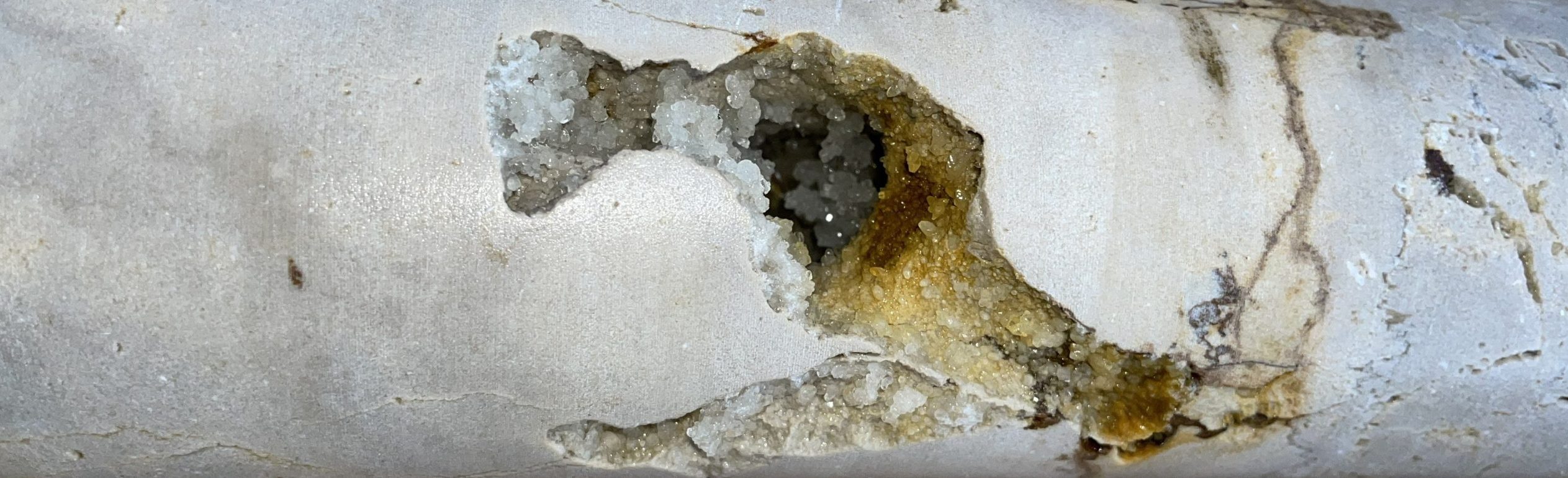
The newly published Geology of the Baraboo Hills, Sauk and Columbia Counties, Wisconsin includes a geologic map of this popular destination and adds to the rich history of geoscience research in the region (Fig. 1). WGNHS geologists Eric Stewart, Esther Stewart, and several collaborators gathered new data from the field and the lab, which resulted in a revision of the stratigraphy of the Precambrian-aged bedrock. This publication, with cartography by Nick Rompa, includes a report, map plate, associated GIS data that showcases the range in geologic time visible in the Baraboo Hills, from rocks that are over 1.7 billion years old, to sand and gravel deposited during the last ice age only 24,000 years ago.
Wisconsin bedrock topography
The WGNHS recently published the first statewide bedrock topography (the elevation of the often-buried bedrock surface) compilation since 1973. Matthew Rehwald used modern GIS tools to compile an enormous amount of data from well construction reports, maps, and rock outcrops. Then, the bedrock surface was modeled using a method that can be repeated as new data are made available; this work fills gaps in many areas of the state where no similar interpretation exists and will be an excellent tool for educational and regional assessment purposes.
Geology of Southwestern Wisconsin
New 1:100,000-scale bedrock geologic mapping of Grant County, also led by Eric Stewart, was released in the WGNHS Bulletin Series. The map was constructed as a fully three-dimensional product, with supplementary data that include rasters (3D surfaces) of all unit contacts with an 18 m grid resolution. The map and associated report provide new baseline information on the distribution of geologic units and interpretation of gentle folds and small faults that deform the Paleozoic sequence.
A new depth-to-bedrock raster of Lafayette County is a continuous model of surficial sediment thickness with a cell size resolution of 10 m. Results show that the depth to bedrock in Lafayette County varies depending on physiographic setting. The largest values occur in the Pecatonica River valley, where more than 30.5 m of unconsolidated sediments overlie bedrock. The depth-to-bedrock raster, in conjunction with other geologic and hydrologic datasets, can be used for various hydrologic, engineering, and geologic hazard assessments.
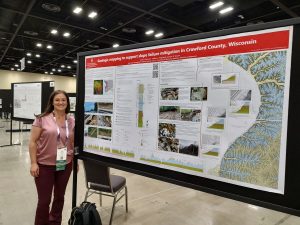
Also published in the last year are 1:24,000-scale maps of the Eastman, Harpers Ferry, Ferryville, and Lansing quadrangles in west-central Crawford County (Fig. 2). The mapping, conducted by Sarah Bremmer, Billy Fitzpatrick, and Eric Stewart, supports the Wisconsin Department of Transportation’s ongoing efforts to mitigate slope failures along the Highway 35 corridor, which runs adjacent to the Mississippi River.
Bedrock mapping also continues in Iowa County on the Earth MRI-funded project to produce new 1:24,000-scale geologic mapping of the Pleasant Ridge and Jonesdale 7.5-minute quadrangles. This mapping offers opportunities to study bedrock features spatially associated with lead-zinc sulfide mineralization.
Geology of Eastern Wisconsin
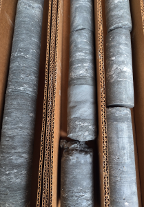
Two ongoing subsurface mapping projects in northeastern Wisconsin aim to characterize depths, thicknesses, and rock properties of Cambrian and Ordovician bedrock units and address regional issues of groundwater quantity and quality. Esther Stewart is leading an effort to generate raster surfaces of the elevation of the top and thickness of the Maquoketa Group, an important aquitard in eastern Wisconsin. The project uses rock core collected in eastern Wisconsin and airborne electromagnetic data collected through a collaboration between the U.S. Geological Survey (USGS), the Wisconsin Department of Agriculture, Trade and Consumer Protection (DATCP), and WGNHS (Fig. 3).
Subsurface mapping in support of water supply and water quality concerns in Outagamie County began in 2024. Characterization of the structure and composition of bedrock units in five 7.5-minute quadrangles aim to clarify sources of arsenic contamination in groundwater. The work builds on previous geochemical and mapping studies that identified elevated arsenic in the sulfide cement horizon at the top of the Ancell Group. The more detailed three-dimensional mapping of the subsurface at 1:24,000 scale will be helpful for determining potential sources of arsenic to private wells in the region.
County bedrock geologic mapping and research
In Jefferson County, Esther Stewart completed mapping of the elevation of several buried bedrock layers including the base of the Platteville Formation (Sinnipee Group), base of the Galena Formation (Sinnipee Group), and the base of the Ancell Group. Work continues to characterize the hydrogeologic properties of the Sinnipee Group dolostone in Jefferson County.
In Dunn County, Eric Stewart completed bedrock and surficial geologic mapping of two 7.5-minute quadrangles (Weston and Menomonie South) at 1:24,000 scale. Mapping was expanded to the entire county in the last year, and efforts to characterize the aquitard integrity in this region have begun. In the next year, Anna Fehling and Pete Chase will collect a suite of hydraulic head measurements within a new borehole to investigate where aquitards are present within the Cambrian stratigraphic section. This information can inform management decisions about groundwater quality and quantity.
Surficial geologic mapping and research
Driftless Area mapping
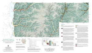
New surficial geologic maps for Crawford, Richland, and Vernon counties are the first of a series of 1:100,000-scale maps of the Driftless Area of southwestern Wisconsin, where the dominant landscape-forming process is fluvial incision in the nearly flat-lying Paleozoic sedimentary bedrock (Fig. 4). Led by Eric Carson, the mapping is supported by high-resolution lidar topographic data and both shallow (direct-push) and deep (rotosonic) sediment coring. The maps, with cartography by Caroline Rose, provide new insights into the nature and distribution of sediments in this region that was never covered by ice during any of the Quaternary glaciations of the last 2.58 million years.
WGNHS Quaternary geologists also continue fieldwork to support 1:100,000-scale mapping in multiple Wisconsin counties including Ashland, Bayfield, Buffalo, Burnett, Green, Price, Jackson, Jefferson, Juneau, Rock, Sauk, and Trempealeau.
Groundwater studies
County groundwater mapping
WGNHS county hydrogeologic atlases offer a comprehensive interpretation and analysis of groundwater resources. They typically encompass assessments of the water-table elevation and groundwater flow directions, depth to the water table, depth to bedrock, distribution of groundwater recharge, and relative vulnerability of groundwater to contamination. With support from Burnett County and the St. Croix Chippewa Indians of Wisconsin, WGNHS published a new hydrogeologic atlas for Burnett County. The previous county atlas was over 35 years old; since then, land use has changed significantly and over 8,000 new wells were drilled, providing new data and allowing for the creation of more detailed and more useful hydrogeologic maps. The WGNHS team included Amy Wiersma, Mark Johnson, Maureen Muldoon, Elmo Rawling, Matt Rehwald,Nick Rompa, and Pete Schoephoester. Similar groundwater mapping projects are ongoing and planned for Douglas, Rock, and Sawyer counties.
Protecting Wisconsin’s Lake Superior coastal resources
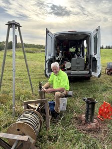
Anna Fehling and Maureen Muldoon are leading a project to evaluate groundwater contributions to Wisconsin’s Lake Superior coastal wetlands. They are characterizing groundwater contribution to six coastal wetlands and developing hydrogeologic cross-sections that illustrate the geologic materials and groundwater flow from the headwaters to each wetland. Field data collected in summer 2025 include water-quality parameters, passive seismic estimates of depth to bedrock, water levels and temperatures in the wetlands, as well as borehole geophysical data in two new bedrock wells (Fig. 5). The team includes Sarah Bremmer, G.E. Graham, and Dave Hart. The project will continue through 2026 and is being conducted in collaboration with the DNR’s Water Use Section and Office of Great Waters and is funded by the U.S. Environmental Protection Agency through the Great Lakes Restoration Initiative.
Hydrogeology of the Silurian dolomite aquifer
The fractured Silurian dolomite aquifer in northeast Wisconsin is vulnerable to groundwater contamination from land-use activities, especially the disposal of human wastewater and dairy manure, which have caused elevated nitrate concentrations and bacteria levels. In the last year, Anna Fehling, Maureen Muldoon, and collaborators developed a preliminary numerical model of groundwater flow for Kewaunee and southern Door counties. Collection of field data for model calibration is ongoing (Fig. 6). The model will be used to assist with predicting aquifer behavior and responding to water quality concerns. The work is being conducted in collaboration with Door County Soil and Water Conservation and Kewaunee County Land and Water.
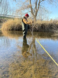
The NR151 legislative code regulates the spreading of agricultural manure, where groundwater resources in the thinly buried Silurian dolomite are particularly sensitive to surface contamination. Maureen Muldoon, Pete Chase, and G.E. Graham completed monitoring to assess the impact of NR151 at one spring site in Calumet County and one farm (well) site in Door County with support by the Wisconsin Coastal Management Program. Since August 2024, they collected monthly samples for nitrate-N and bacteria. Quarterly pathogen sampling began in October 2024. The WGNHS scientists concluded that the sampling frequencies for this project were not adequate to capture the full temporal variability in these parameters. However, looking at the sampling results in the context of recharge events and manure applications on the farm’s fields explains some of the variability.
Hydrogeology of the Chequamegon-Nicolet National Forest
The Bend Copper-Gold Deposit is a volcanogenic massive sulfide deposit located in the Medford District of the Chequamegon-Nicolet National Forest (CNNF), Taylor County, Wisconsin. G.E. Graham, Sue Swanson, and Pete Chase completed three years of water level and water quality monitoring at the Bend site and plan to publish results in the coming year. If a mine were ever proposed, approved, or developed, or if there were other changes to land use in the region, this dataset would serve as a reference for management of surface water and shallow groundwater resources. The work is supported by the U.S. Forest Service (USFS).
Following multiple years of above-average precipitation and extreme rainfall in 2018, Pigeon Lake and nearby seepage lakes in the Washburn-Great Divide District of the CNNF experienced groundwater flooding, which damaged roads and surrounding homes. To understand the causes of the flooding and evaluate future risks, the USFS and WGNHS conducted a four-year field study describing water levels, water chemistry, and groundwater-surface interactions. In the last year G.E. Graham, along with Sue Swanson, Pete Chase, and Mike Cardiff (UW–Madison), developed a groundwater flow model for Pigeon Lake to assess potential lake-level responses under wetter climate scenarios. The team plans to publish results of the entire project in the coming year.
Southwest Wisconsin hydrogeology
The hydrogeology of southwest Wisconsin is characterized by a multi-aquifer system with individual aquifers separated by leaky aquitards. To better understand groundwater flow in this complex system and to inform well construction practices, Sarah Bremmer is investigating the 3D distribution and hydrogeologic properties of two units that have been interpreted as bedrock aquitards. Work continues on construction of an isopach map of the Glenwood Formation and a depth-structure raster for the top Pecatonica Member of the Platteville Formation, both at 1:100,000-scale. Maureen Muldoon and Nick Rompa are also continuing work on a new 1:100,000-scale water-table map for Grant County.
Wisconsin Groundwater–Level Monitoring Network
The WGNHS continues to participate in the Wisconsin Groundwater-Level Monitoring Network with support from the U.S. Geological Survey’s National Ground-Water Monitoring Network program. Pete Chase, Sarah Bremmer, and Irene Lippelt work closely with the USGS Upper Midwest Water Science Center and the DNR to operate, maintain, and manage the network. In the last year, the team published an open file report summarizing network improvements between 2022-2024. Field work is also complete on our NGWMN 2024-2026 grant including well maintenance activities (e.g., borehole geophysical logging, slug testing) on seven wells to ensure that data collected from these wells are of high quality.
Outreach
Over the last year, WGNHS has participated in nearly 50 educational outreach activities in 20 counties for the public, industry groups, government, and other state, local, and national collaborators. Several WGNHS staff members regularly present to the public as part of UW-Madison’s Badger Talks. Maureen Muldoon’s Wisconsin Karst Aquifers Badger Talk can be viewed through PBS Wisconsin’s University Place.
Additional new educational materials include Water WELLness: Managing Your Private Well Water System, an informational guide to help users understand some of the issues around managing a private drinking water well system and keeping it maintained. This free online course was developed through a collaboration between the University of Wisconsin–Madison Division of Extension Natural Resources Institute, the WGNHS, and the University of Wisconsin–Stevens Point Center for Watershed Science and Education in the College of Natural Resources.
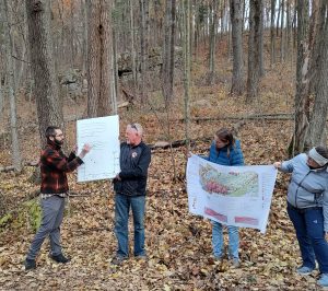
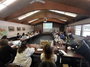
Our successful groundwater education workshops for Wisconsin teachers, naturalists, or other educators also continued, with training provided by staff from the WGNHS, the Wisconsin DNR, UW-Stevens Point Center for Watershed Science and Education, and the UW-Madison, Division of Extension’s Natural Resources Institute. This year we added an additional workshop for County Health and Conservation staff. It included training on Wisconsin’s aquifers and groundwater susceptibility to contamination (Fig. 7). Resources for communicating health risks and treatment options associated with private well contamination, with a specific focus on emerging contaminants (e.g., neonicotinoids, PFAS) were also provided.
This year’s publications
WGNHS launched a Mapping Status Portal this year, which is a map-based interface to help discover our maps and publications. The viewer shows areas of Wisconsin with mapping status (complete or in progress) for bedrock geology, surficial geology, water table, bedrock topography, and other groundwater maps. The portal also directly links to our Publications Catalog so that users can view and download materials.
Over the last year, Ian Orland and Liz Ceperley coordinated peer-review and production of fourteen new WGNHS publications by WGNHS staff and collaborators! You can find these products, and all our archived publications, in the Publication Catalog on our website.
Reports
Bremmer, S.E., and Chase, P.M., 2025, Wisconsin Groundwater-Level Monitoring Network improvements, 2022-2024: Wisconsin Geological and Natural History Survey Open-File Report 2025–03, 168 p., https://doi.org/10.54915/utaf6868.
Bremmer, S.E., Fitzpatrick, W.A., and Stewart, E.D., 2025, Geologic map of the Eastman and Harpers Ferry 7.5-minute quadrangles, Crawford County, Wisconsin: Wisconsin Geological and Natural History Survey Open-File Report 2025–01, 29 p., 1 pl., scale 1:24,000, https://doi.org/10.54915/scow1765.
Carson, E.C., and Christensen, A.M., 2025, Quaternary geology of Crawford, Richland, and Vernon counties, Wisconsin in Quaternary geology of Vernon County, Wisconsin: Wisconsin Geological and Natural History Survey Map 513-Supplement, 21 p., 1 pl., scale 1:100,000, https://doi.org/10.54915/jpzs9081.
Fitzpatrick, W.A., Bremmer, S.E., and Stewart, E.D., 2025, Geologic map of the Ferryville and Lansing 7.5-minute quadrangles, Crawford County, Wisconsin: Wisconsin Geological and Natural History Survey Open-File Report 2025–02, 24 p., 1 pl., scale 1:24,000, https://doi.org/10.54915/rjkl4646.
Stewart, E.D., Mauel, S.W., Bremmer, S.E., and Fitzpatrick, W.A., 2025, Bedrock geology of Grant County, Wisconsin: Wisconsin Geological and Natural History Survey Bulletin 119, 33 p., 1 pl., scale 1:100,000, https://doi.org/10.54915/xdjk3760.
Stewart, E.D., Stewart, E.K., Crouch, K.A., Aleksey, M., Brengman, L.A., and Fitzpatrick, W.A., 2025, Geology of the Baraboo Hills, Sauk and Columbia counties, Wisconsin: Wisconsin Geological and Natural History Survey Bulletin 120, 43 p., 1 pl., scale 1:50,000, https://doi.org/10.54915/jkkg8792.
Wiersma, A.K., Rehwald, M.J., Schoephoester, P.R., and Muldoon, M.A., 2026, Hydrogeologic atlas of Burnett County, Wisconsin: Wisconsin Geological and Natural History Survey Technical Report 008, 23 p., 2 pls., scale 1:100,000, https://doi.org/10.54915/wxef8967.
Maps
Carson, E.C., and Christensen, A.M., 2025, Quaternary geology of Vernon County, Wisconsin: Wisconsin Geological and Natural History Survey Map 513, 21 p., 1 pl., scale 1:100,000, https://doi.org/10.54915/jpzs9081.
Carson, E.C., and Christensen, A.M., 2025, Quaternary geology of Crawford County, Wisconsin: Wisconsin Geological and Natural History Survey Map 514, 1 pl., scale 1:100,000, https://doi.org/10.54915/uddu2475.
Carson, E.C., and Christensen, A.M., 2025, Quaternary geology of Richland County, Wisconsin: Wisconsin Geological and Natural History Survey Map 515, 1 pl., scale 1:100,000, https://doi.org/10.54915/ptqi5841.
Data Series
Haas, L.D., Rehwald, M.J., Hart, D.J., and Calkins, C.A., 2025, Depth to Silurian bedrock in eastern Wisconsin: Wisconsin Geological and Natural History Survey Data Series 004, 29 p., https://doi.org/10.48358/ihyi3520.
Stewart, E.D., Hart, D.J., Bremmer, S.E., and Mauel, S.W., 2025, Depth to bedrock in Lafayette County, Wisconsin: Wisconsin Geological and Natural History Survey Data Series 005, 12 p., https://doi.org/10.48358/jzba5598.
Mauel, S.W., Stewart, E.D., Hart, D.J., and Muldoon, M.A., 2025, Depth to bedrock in Grant County, Wisconsin: Wisconsin Geological and Natural History Survey Data Series 006, 12 p., https://doi.org/10.48358/gjfs9135.
Rehwald, M.J., and Rawling, J.E., III, 2026, Wisconsin bedrock topography, 100-meter resolution: Wisconsin Geological and Natural History Survey Data Series 007, 22 p., https://doi.org/10.48358/gclw7508.
Journal articles published by WGNHS staff and collaborators
Baker, E.A., Juckem, P., Feinstein, D. and Hart, D., 2025, A Regional Model Comparison between MODPATH and MT3D of Groundwater Travel Time Distributions. Groundwater, 63: 861-873. https://doi.org/10.1111/gwat.70024.
Ceperley, E.G. and Marcott S.A., 2025 Paired cosmogenic analysis reveals early Pleistocene burial and exposure history in northwest Greenland. GSA Bulletin, 137 (7-8): 3340–3350. https://doi.org/10.1130/B37910.1.
Gotkowitz, M. and Hart, D., 2026, Aquitards in Groundwater Systems: Groundwater Special Issue. Groundwater, 64: 4-5. https://doi.org/10.1111/gwat.70044.
Núñez Ferreira, F.A., Zoet, L.K., Rawling III, J.E., Haseloff, M., Rehwald, M. and Ullman, D.J., 2025, Subglacial hydrology insights from eskers developed atop soft beds of the Laurentide ice sheet. Earth Surface Processes and Landforms, 50(1), e6037. https://doi.org/10.1002/esp.6037.
Stewart, E.D., Fitzpatrick, W.A., and Stewart, E.K., 2025, Improved Groundwater Arsenic Contamination Modeling Using 3-D Stratigraphic Mapping, Eastern Wisconsin, USA. Water 17 (13). https://doi.org/10.3390/w17132024.
Volpano, C.A., Zoet, L.K., Theuerkauf, E.J., and Rawling III, J E., 2025, Modeling the influence of grounded landfast ice on nearshore sediment transport. Journal of Geophysical Research: Earth Surface, 130, e2024JF008080. https://doi.org/10.1029/2024JF008080.