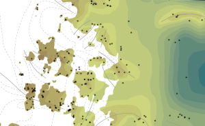
Located in southeast Wisconsin, Jefferson County is almost entirely blanketed by sediments that were delivered or shaped by the ice sheet that covered this area during the last ice age. Recent mapping interprets the distribution of the bedrock surface that is buried beneath those glacial sediments as interpreted by three drill cores, over 13,000 well construction reports, examination of well cuttings, and 34 geochemical profiles of boreholes.
These new raster elevation surfaces help to visualize the buried bedrock bedrock surfaces that are important for managing local groundwater resources. The accompanying report provides insight on how those buried surfaces are modeled, and this includes 7 map plates of key surfaces and unit thicknesses across the county.